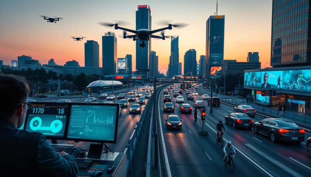
You know the frustration: a routine trip turns into a long delay and a missed appointment. Cities that once accepted unpredictability are now using connected tools to restore their time and calm through a modern smart city traffic management system.
In 2026, advances in AI, edge computing, and faster networks let a unified platform make near-real-time choices. This delivers predictable trips, lower emissions, and safer streets by tying detection, signals, and communications into a single, coherent smart city traffic management system.
Proven deployments ― from Los Angeles’ adaptive signal project to pilot programs in Pittsburgh and San Francisco ― show measurable gains: intersection delays cut by about 32% and citywide emissions reduced noticeably. You’ll see how sensors, software, and clear governance move pilots into scalable production.
Key Takeaways
- You’ll learn how a unified approach cuts congestion and makes travel times more reliable.
- AI, edge processing, and faster networks enable near-real-time decision-making for city operations.
- Sensors, networks, and control centers are the practical building blocks you need.
- Measured benefits include reduced delays, improved safety, and lower emissions.
- Examples from U.S. cities show paths from pilots to citywide rollouts.
Why this ultimate guide matters now for U.S. cities
Congestion is costing U.S. commuters and local businesses billions each year. In 2022, highway delays led to an estimated $94.6B in wasted time and fuel. Those losses make transportation planning urgent for your city and for urban areas nationwide.
Concrete results show what’s possible. Los Angeles’ ATSAC reduced intersection delays by 32% and emissions by 3%. New York’s 2025 pricing cut vehicles by about 1 million in month one and sped crossings by 10–30%. Adaptive deployments in Pittsburgh trimmed travel times by 25% and idling by 40%.
- You face rising costs and resident frustration today; reform is a near-term priority.
- This guide gives evidence-based guidance grounded in U.S. outcomes for faster trips and less congestion.
- Modern systems turn real-time data into action, improving peak-hour flow without mega-projects.
- You’ll learn how to prioritize corridors for the biggest time and reliability gains.
- Use shared data and clear KPIs to align transportation goals with equity, safety, and economic goals.
What a smart city traffic management system is and how it works
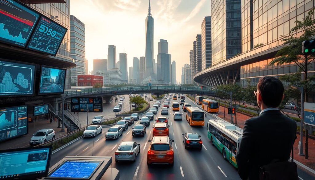
Cities deploy integrated platforms that turn raw field signals into timely operational choices. At its core, the Intelligent Transportation System links field devices, intersections, and a central control center so you can manage flows proactively instead of reacting after delays occur.
From intelligent transportation to connected, adaptive networks
This approach pairs sensors with edge processing and cloud analytics so detection, processing, and response happen fast. Radar, cameras, RFID, air-quality, and occupancy sensors feed high-fidelity data that software converts into actionable information in near real time.
Core components: sensors, software, communications, control centers
- The field layer uses IoT sensors and connected video to monitor intersections and approaches.
- Edge processing reduces latency so vehicles, pedestrians, and cyclists are detected quickly.
- Communications link devices and infrastructure to centralized platforms for timing, traveler information, and incident workflows.
- Adaptive signal control at traffic lights balances modes, prioritizes buses and emergency vehicles, and optimizes throughput.
- Historical data and analytics tune timing strategies and let the system scale from a few intersections to citywide deployments.
The technology stack powering smarter traffic in 2026
Modern stacks fuse radar, vision, and edge processing so you get near-instant detection and response. Choose components that work together to turn sensor feeds into safe, measurable action.
AI-powered sensors and computer vision
Omnisight’s FusionSensor combines HD3D radar and HD video to build dense point clouds. On-device TrueEdge processing runs at 20 Hz and hits 98.7% accuracy for counts, classification, speed, and occupancy.
Adaptive signal control and edge TIM
Adaptive software trims waits up to 40% and can cut harmful emissions by 20% by adjusting phases in milliseconds. Connected video with edge TIM detects incidents faster and speeds clearance.
Cloud, edge, 5G and V2X
Edge analytics keep detection reliable in poor lighting or weather where radar excels. 5G-Advanced and V2I/V2X enable ultra-low latency links for predictive flow optimization and route guidance.
- Select sensors that fuse radar and vision for reliable detection of vehicles and vulnerable road users.
- Design edge processing so crucial decisions execute in milliseconds, not seconds.
- Use open interfaces and embed safety logic into controllers for pedestrian protection and transit priority.
| Component | Role | Key metric |
|---|---|---|
| FusionSensor (radar+video) | Accurate detection & classification | 98.7% accuracy @ 20 Hz |
| Edge processors | Low-latency decisioning | Milliseconds execution |
| Adaptive signal software | Reduce idle time | Up to 40% wait reduction |
| 5G / V2X links | High-throughput, low-latency comms | Supports predictive control |
Proven benefits you can measure: from congestion to safety and emissions
Measurable results show how targeted upgrades deliver shorter trips and cleaner air across major corridors. You can quantify gains with before-and-after studies that track delays, variability, and travel time reliability.
Reduced travel times and smoother flow across corridors and intersections
Los Angeles’ ATSAC cut delays by 32%, and Pittsburgh’s Surtrac trimmed travel times by 25% while lowering idle time by 40%. These outcomes translate into fewer minutes lost and steadier travel across busy roads.
Enhanced safety for pedestrians, cyclists, and vehicles with real-time detection
Faster hazard detection lowers conflict rates near turn lanes and crosswalks. Portland TriMet’s priority work shows improved bus reliability and safer boarding for people who rely on transit.
Lower emissions and better air quality through less idling and smarter routing
Adaptive approaches can cut waiting times up to 40% and emissions up to 20%. LA’s program produced a 3% citywide emissions drop, and Juniper Research projects large CO2 reductions by 2027.
- Quantify corridor time savings with KPIs and audits.
- Document safety gains for walking and biking with incident metrics.
- Track emissions and air quality at key corridors to validate climate alignment.
- Estimate economic benefit from reduced delays, better deliveries, and higher downtown activity.
| Metric | Example | Impact |
|---|---|---|
| Delay reduction | Los Angeles ATSAC | 32% fewer intersection delays |
| Travel time | Pittsburgh Surtrac | 25% faster trips |
| Emissions | Adaptive timing pilots | Up to 20% lower emissions |
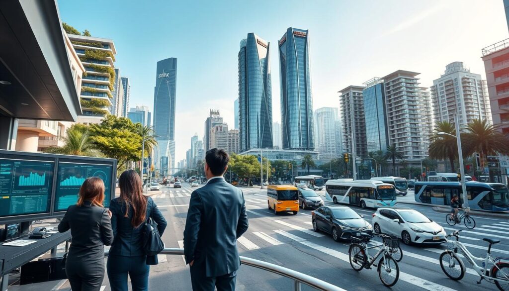
How to implement a smart city traffic management system
Begin with a practical audit that measures today’s delays, signal timing, and incident response.
Assessment and planning: benchmark corridor performance, set measurable goals, and create governance that includes public outreach. Collect field counts, video logs, and travel-time data so your planning uses verifiable information.
Prioritization and partnerships: pick corridors for early wins and assemble funding partners. Iteris’ $3M TxDOT work in San Antonio, Kapsch’s deployment in Ribeirão Preto, and Thales’ Avinor partnership show how phased pilots and vendor ecosystems reduce rollout risk.
Pilot testing and integration
Run live pilots to validate devices, software, and interoperability. Standardize data models to ease integration and plan upgrades that scale from corridors to citywide applications.
Deployment and training
Create deployment playbooks, field checklists, and training so operators can run the management system consistently. Structure contracts around outcomes and KPIs to align vendor delivery with performance goals.
Continuous assessment
- Define KPIs and retiming cycles tied to observed data.
- Harden infrastructure and software for security and resilience.
- Coordinate incident response with emergency services and transit priority.
| Pilot | Partner | Key outcome |
|---|---|---|
| San Antonio mobility | Iteris | Contracted enhancements to safety and flow |
| Ribeirão Preto ITS | Kapsch | Phased deployment and interoperability validation |
| Norway UTM rollout | Thales & Avinor | Nationwide scaling and data integration |
Real-world success stories shaping U.S. urban mobility
Practical pilots and scaled rollouts in U.S. towns reveal repeatable gains in travel time and reliability. These examples show how targeted investments in detection, signal timing, and enforcement move results from pilot corridors into broader deployments.
Los Angeles ATSAC
Scale and results: ATSAC expanded from 118 to 4,850 adaptive signals. Intersection delays fell about 32% and emissions dropped roughly 3% citywide. You can use this as a benchmark for corridor retiming and phased rollout.
Pittsburgh and San Jose
Pittsburgh’s AI coordination (Surtrac) cut travel times 25% and idle time 40%, improving safety at key turns. San Jose’s transit priority reduced bus travel times by over 50% and lifted VTA ridership ~15% in early 2024.
New York City pricing and West Coast enforcement
NYC’s congestion pricing removed about 1M vehicle trips in month one, improving key crossing times 10–30%. San Francisco’s AI-assisted bus lane enforcement cut violations ~47%, while Oakland’s enforcement led to 787 citations from 1,100+ flagged events.
Portland, Kansas City, and smaller adopters
Portland TriMet’s priority and detection work improved schedule adherence and safety. Kansas City tied parking, lighting, and transit to reduce delays and increase parking availability. Dubuque used existing cameras and video analytics to speed incident response and smooth flow without huge capital outlays.
- What you’ll take away: benchmarks for time, emissions, and safety based on real deployments.
- Practical practices: data governance, retiming cycles, enforcement pairing, and pilot-to-scale playbooks.
- Use these cases to estimate gains on your corridors and set measurable KPIs.
| Program | Key outcome | Metric |
|---|---|---|
| Los Angeles ATSAC | Citywide adaptive timing | Delays −32%, Emissions −3% |
| Pittsburgh Surtrac | AI signal coordination | Travel time −25%, Idle −40% |
| San Jose TSP | Transit priority | Bus time −50%+, Ridership +15% |
Data strategy, cybersecurity, and infrastructure you can trust
Protecting data and infrastructure is now a core part of any urban transportation plan. Your architecture must blend real-time feeds with historical stores so analytics and reporting work at scale.
Designing a resilient data architecture: real time + historical analytics
Run edge processing for time-critical decisions and sync summarized records to cloud archives. Use on-vehicle transfer tools like Lyve Mobile to move video and sensor files without loss.
Privacy, security, and governance for interconnected systems
Enforce policies for collection, retention, and access. Segment networks, apply least-privilege for operators, and harden devices and software against intrusion.
Reliable storage and multicloud options for transportation data at scale
Choose storage that handles high-volume video and logs. Seagate options—Exos E 4U106 JBOD, Exos CORVAULT, Exos E 5U84 JBOD, and Lyve Cloud—give multicloud resilience and cost control.
- Design fusion of live feeds and long-run repositories for reliable insights.
- Automate edge processing and keep summarized information in the cloud for analysis.
- Plan redundancy, test incident playbooks, and monitor data quality and lineage.
| Need | Approach | Example |
|---|---|---|
| Low-latency control | Edge processing | On-device analytics |
| Large video storage | JBOD + Lyve Cloud | Exos CORVAULT |
| Secure transfers | Mobile to cloud | Lyve Mobile |
Trends and challenges to prepare for by 2026
Prepare for a near-term wave of connected devices and faster links that will change how roads respond to demand. These advances will shift decision-making closer to the field and make forecasting more accurate.
AIoT, edge intelligence, and 5G-Advanced enabling near-instant responses
AIoT merges AI with IoT to improve short-term forecasts and reduce delays. Edge computing keeps critical actions local so responses hold up in poor networks. 5G-Advanced and V2I links enable ultra-low latency connections for connected vehicles and roadside units.
Interoperability and standards to break data silos
Open APIs and agreed data models let transportation systems and public safety platforms share information. This reduces vendor lock-in and speeds integrations across agencies.
Funding, regulation, and equity-centered policy
You should align procurement and governance so pilots scale fairly. Structure funding to reward measurable gains and include accessibility and equity in contract KPIs.
Sustainable operations and measurable CO2 reductions
LED signal retrofits can cut energy use up to 80%. Predictive analytics can reduce average delays by as much as 30%, improving efficiency and lowering emissions.
- Plan V2X pilots to connect vehicles to intersections for safer merging and smoother flow.
- Codify data sharing and software lifecycle policies to keep systems secure and current.
- Set KPIs that quantify air and CO2 benefits alongside congestion and safety goals.
| Trend | Benefit | Metric |
|---|---|---|
| AIoT + edge | Faster, local decisions | Delay reduction up to 30% |
| Open standards | Cross-agency data sharing | Fewer integration hours |
| LED & efficiency upgrades | Lower energy use | Energy −80% at signals |
Conclusion
A focused, phased approach turns proven deployments into lasting improvements for residents and businesses. Across U.S. deployments, adaptive signals, enforcement, and pricing delivered 10–30% faster crossing times and up to 25% shorter trips. That means measurable gains in transportation time and safety that you can report to stakeholders.
Use a clear traffic management blueprint that ties technology to policy and funding. Combine resilient storage and multicloud architectures so your data and analytics scale reliably while protecting privacy and uptime.
Act now: pilot, prove, and expand solutions that prioritize corridors with the fastest returns. With targeted parking and curb strategies, interoperable systems, and outcome-driven management, you can improve travel quality, lower emissions, and make roads safer across your city.
FAQ
How will a smart city traffic management system change travel in U.S. cities by 2026?
By combining AI-enabled sensors, adaptive signal control, and faster communications like 5G, these platforms will reduce delays, lower emissions, and improve safety. You’ll see shorter corridor travel times, fewer stops at intersections, and faster emergency vehicle response through prioritized signaling and predictive routing.
Why should your city prioritize this guide right now?
Federal and state funding streams, rising congestion costs, and stricter air quality goals make this moment critical. You can secure grants, demonstrate quick wins with pilots, and align projects with equity and climate targets to unlock long-term operational savings.
What exactly does a modern traffic system include, and how does it operate?
It integrates sensors, cameras, communications, edge and cloud processing, and centralized control. Devices collect vehicle, pedestrian, and environmental data; algorithms analyze flows in real time; and controllers adjust signals and routing to optimize throughput and safety.
What core components should you budget for first?
Prioritize robust sensors and video, adaptive signal controllers, secure communications (fiber, 5G), edge compute nodes, and a unified operations center dashboard. Include analytics software for KPIs and data storage that supports historical reporting and machine learning.
How do AI-powered sensors and computer vision improve detection?
They deliver higher accuracy in diverse weather and lighting, identify pedestrians and bikes, and reduce false activations. On-device processing lowers latency and preserves bandwidth by sending only events or compressed metadata to central systems.
Can adaptive signal control cut delays without major roadwork?
Yes. Adaptive controllers dynamically change phase timings based on real-time demand. You’ll reduce idle time at intersections and smooth platoons of vehicles, often with minimal physical infrastructure changes beyond new controllers and communication links.
What role do edge computing and 5G play in operational performance?
Edge compute processes sensor data near the source, enabling near-instant decisions for safety-critical events. 5G provides low-latency, high-throughput links for video and V2X messaging, supporting tighter coordination across intersections and transit priority systems.
How do V2I and V2X communications affect traffic flow?
Vehicle-to-infrastructure and vehicle-to-everything communications allow predictive optimization: signals can advise approaching vehicles, transit vehicles gain priority, and incident alerts propagate quickly. This reduces stop-and-go behavior and improves throughput across corridors.
What measurable benefits should you expect after deployment?
Expect reduced travel times, fewer collisions at complex intersections, lower tailpipe emissions, and improved bus speeds and reliability. These gains translate to economic benefits like reduced fuel use, time savings, and increased transit ridership.
How do these systems enhance safety for pedestrians and cyclists?
Real-time detection flags vulnerable road users and triggers longer walk phases or protective signal timing. Cameras and analytics alert operators to near-miss patterns so you can redesign intersections or adjust timings to cut collision risk.
What steps should you follow to implement a network successfully?
Start with assessment and baseline studies, set clear goals, secure funding, and form public–private partnerships. Run targeted pilots that prove interoperability, then scale with phased deployments, training for operators, and community engagement throughout.
How do you ensure interoperability and future upgrades?
Adopt open standards for controllers, communications, and data formats. Specify APIs and vendor-neutral middleware so you can swap components, add new sensors, and integrate third-party analytics without costly rip-and-replace projects.
What data strategy, privacy, and security controls are essential?
Design a layered architecture with secure edge-to-cloud encryption, role-based access, and audit logging. Implement privacy-by-design for video and personal data, anonymize datasets, and maintain governance policies that meet federal and state requirements.
How do you measure success after launch?
Track KPIs such as average corridor travel time, intersection delay, vehicle throughput, transit on-time performance, emergency response time, and emissions metrics. Use dashboards and routine reports to guide iterative optimization.
What common funding and policy hurdles should you prepare for?
You’ll face procurement complexity, interagency coordination, and equity concerns. Mitigate these by exploring grant programs, creating clear governance structures, and ensuring projects benefit underserved neighborhoods with transparent community outreach.
Can smaller cities replicate successes from larger deployments?
Absolutely. Scalable architectures and modular solutions let smaller municipalities adopt proven technology affordably. Start with corridor-level projects, leverage managed services, and expand as you demonstrate ROI and operational capacity.
Also Read This:-
How AI in Photography Is Changing the Way We Capture and Edit Photos
Best Free AI Tools for Digital Marketing Beginners in 2026
AI in Agriculture: How Smart Technology Is Transforming Farming